
Sunday, July 12, 2026 | U.S. Weather Today: Record Heat Threatens the West as Severe Storms and Flooding Target the Southeast
By Refocused Newsroom
Sunday, July 12, 2026
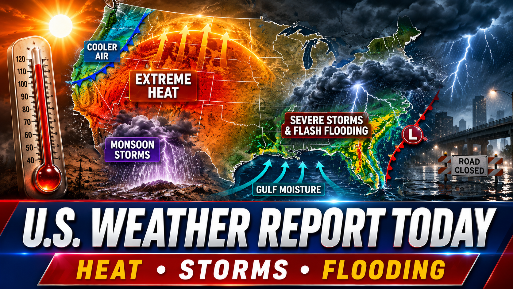
A sprawling and dangerous weather pattern is dividing the United States this Sunday.
Potentially record-breaking heat is gripping the Great Basin, Intermountain West and northern Plains, while rounds of thunderstorms threaten flash flooding across the southern Appalachians and Carolinas. Severe storms are also possible in parts of the Southeast, Arizona and Michigan’s Upper Peninsula.
As the new week begins, the center of the heavy-rain threat is expected to migrate toward the Gulf Coast and Texas, while extreme heat expands farther into the Plains and Midwest.
Dangerous Heat Peaks Across the West and Northern Plains
The most serious weather story today is the intense heat stretching from the Great Basin into Montana and the northern Plains.
The National Weather Service expects widespread triple-digit temperatures across this corridor. Some locations could challenge all-time temperature records, not simply daily records for July 12.
Salt Lake City could approach its all-time record high of 107 degrees, while Billings, Montana, could challenge its record of 108 degrees. The heat will also affect portions of Nevada, Idaho, Wyoming, Utah, Montana and the Dakotas.
The heat is being produced by an unusually powerful area of high pressure over the western United States. This atmospheric ridge acts like a lid, suppressing cooler air and allowing temperatures to climb day after day.
A cold front will begin bringing some relief from the Pacific Northwest into portions of Montana, but the dangerous heat is expected to continue farther east. Temperatures well above 100 degrees are forecast across portions of the northern Plains early this week.
Dry and breezy conditions may also increase wildfire danger in parts of the West. Current National Weather Service alerts include extreme-heat warnings, heat advisories, red-flag warnings and fire-weather watches in affected regions.
Residents should limit strenuous outdoor activity during the hottest part of the day, drink water regularly and check on older adults, children and neighbors without reliable air conditioning.
Flash-Flood Threat Stretches Into the Carolinas
While the West bakes, the Southeast is dealing with the opposite problem: too much moisture and slow-moving thunderstorms.
The Weather Prediction Center has placed portions of Kentucky, Tennessee, southern Virginia and the Carolinas under a Slight Risk of excessive rainfall today.
Storms may repeatedly move across some of the same communities, producing locally intense downpours. Atmospheric moisture levels are unusually high, and some areas have already received enough rain to make the ground more vulnerable to additional flooding.
The greatest concern extends from portions of Kentucky and Tennessee through the southern Appalachians and into North and South Carolina.
The exact placement of the heaviest rain remains uncertain because local boundaries, cloud cover and daytime heating will determine where thunderstorms become most concentrated. However, isolated flash flooding is considered likely, and one or two corridors of more concentrated impacts could develop.
Drivers should never attempt to cross flooded roads. Even shallow-looking water can hide washed-out pavement or carry a vehicle away.
Severe Thunderstorms Possible in Three Main Regions
The Storm Prediction Center has identified three separate areas with an elevated risk of severe thunderstorms today:
- Eastern Georgia into the Carolinas
- Southern and central Arizona
- Michigan’s Upper Peninsula
Across the Carolinas and Southeast, thunderstorms may produce isolated to scattered damaging wind gusts during the afternoon and evening. Storms could initially develop near the Appalachian Mountains before spreading eastward.
Additional storms near Florida’s Atlantic sea breeze could also generate isolated damaging winds.
Farther north, the Upper Peninsula of Michigan faces a risk of severe thunderstorms capable of producing damaging winds and large hail. The atmospheric setup could support rotating supercell thunderstorms, with isolated hailstones potentially exceeding two inches in diameter.
The severe-weather threats are geographically separated, but they share one common ingredient: strong daytime heating interacting with unstable and moisture-rich air.
Arizona Monsoon Begins Making Noise
Monsoonal moisture is expanding across Arizona and New Mexico, increasing the chances for thunderstorms, strong winds and localized flash flooding.
Thunderstorms are expected to develop over Arizona’s higher terrain before moving toward lower elevations during the afternoon and evening. The primary severe-weather concern is damaging wind produced when rain-cooled air rushes downward and spreads across the desert.
These storms can generate dangerous wind gusts even in areas receiving little rain. Blowing dust may suddenly reduce visibility along highways, particularly across southern and central Arizona.
The Weather Prediction Center also includes much of Arizona within a Marginal Risk of excessive rainfall. Rainfall flowing over steep terrain, slot canyons and wildfire burn scars can create dangerous flash flooding far from the storm that produced it.
Monsoonal thunderstorms are expected to become more widespread across the Southwest and Four Corners region later this week.
Heavy Rain Shifts Toward Texas and the Gulf Coast
The storm system affecting the Southeast today will gradually redirect deeper moisture toward the central Gulf Coast and Texas.
By Monday and Tuesday, the risk of heavy rain and flash flooding is expected to increase across portions of central Texas and communities closer to the Gulf Coast. Gulf moisture will remain pooled near a slow-moving frontal boundary, allowing repeated thunderstorms to develop.
The threat may continue deeper into the week. The Weather Prediction Center expects increased flooding concerns across western and south-central Texas Wednesday and Thursday as Gulf and Pacific moisture interact with another disturbance.
Rainfall during the first part of the week could saturate the ground, making later storms more capable of producing runoff and flash flooding.
Texas residents should monitor local forecasts closely, especially in flood-prone neighborhoods and areas near creeks, rivers and low-water crossings.
Midwest and Northeast Face Expanding Heat
The core of the heat remains over the West and northern Plains today, but the pattern will not stay frozen in place.
The strong upper-level ridge is expected to stretch into the Midwest and toward the Mid-Atlantic during the middle of the week. Major to Extreme HeatRisk could persist from the Dakotas into parts of the Midwest through next weekend.
The Great Lakes, Northeast and Mid-Atlantic are also expected to experience periods of above-average heat through Wednesday. A cold front may eventually push some of the hottest air southward, but warm and humid conditions could return later in the week.
Rounds of thunderstorms may accompany the frontal boundary as it passes through the Great Lakes, Northeast and Mid-Atlantic. Forecasters are already monitoring the possibility of another severe-weather threat in the Mid-Atlantic by Friday.
Pacific Northwest Begins to Cool
The Pacific Northwest is positioned near the edge of the western heat dome.
A cold front moving inland is expected to bring cooler air into portions of Washington, Oregon and eventually Montana. The change will not instantly eliminate fire-weather concerns, particularly where vegetation is dry and winds increase behind the front.
Temperatures should moderate first in the Pacific Northwest while dangerous heat remains entrenched farther inland and eastward.
That creates a sharp dividing line between improving conditions near the coast and potentially record-setting temperatures across the interior West.
Atlantic Tropics Remain Quiet
The Atlantic hurricane basin remains quiet for now.
The National Hurricane Center said tropical cyclone formation is not expected anywhere across the North Atlantic, Caribbean Sea or Gulf during the next seven days. No active tropical cyclones were present in the Atlantic as of Sunday morning.
Conditions are more active in the Pacific.
Forecasters are monitoring a broad area of low pressure several hundred miles south of Mexico. Environmental conditions could support gradual organization, and a tropical depression may form during the early or middle part of the week while remaining offshore.
Other disturbances are being tracked west of Baja California and well south of Hawaii, but no active tropical cyclones were present in the eastern or central Pacific Sunday morning. The disturbance south of Hawaii was expected to remain far from the islands in the immediate forecast period.
Alaska and Hawaii
Alaska’s weather remains highly regional.
Portions of southeastern Alaska are expected to experience generally drier conditions today, although isolated showers and areas of morning fog remain possible. Parts of south-central Alaska continue to face localized fire-weather concerns, while other interior and western communities may see scattered showers or thunderstorms.
Hawaii is not facing an immediate tropical-cyclone threat. A weak disturbance remains several hundred miles south of the islands, with only a low chance of development during the next couple of days.
What to Expect This Week
The national weather pattern will remain active through at least the middle of the week.
Dangerous heat will continue across the northern Plains and Midwest, potentially producing several days of record or near-record daytime and nighttime temperatures.
Heavy rain will shift from the southern Appalachians and Carolinas toward the Gulf Coast and Texas. Monsoonal moisture will continue expanding across the Southwest, raising the risk of thunderstorms and localized flash flooding.
Later in the week, heat and thunderstorm chances may again increase across the Great Lakes, Northeast and Mid-Atlantic.
The map may look divided, but the hazards share a common message: weather conditions can change quickly, and local warnings matter more than broad regional forecasts.
Sources and Full Links
- National Weather Service: National forecast, alerts and hazards
https://www.weather.gov/ - NOAA Weather Prediction Center: Short-Range Forecast Discussion
https://www.wpc.ncep.noaa.gov/discussions/hpcdiscussions.php?disc=pmdspd - NOAA Weather Prediction Center: Day 1 Excessive Rainfall Outlook
https://www.wpc.ncep.noaa.gov/qpf/ero.php?day=1&opt=curr - NOAA Weather Prediction Center: Day 2 Excessive Rainfall Outlook
https://www.wpc.ncep.noaa.gov/qpf/ero.php?day=2&opt=curr - NOAA Weather Prediction Center: Extended Forecast Discussion
https://www.wpc.ncep.noaa.gov/discussions/pmdepd.html - NOAA Storm Prediction Center: Day 1 Severe-Thunderstorm Outlook
https://www.spc.noaa.gov/products/outlook/day1otlk.html - National Hurricane Center: Graphical Tropical Weather Outlook
https://www.nhc.noaa.gov/gtwo.php - National Hurricane Center: Active Atlantic and Pacific Systems
https://www.nhc.noaa.gov/ - NOAA Weather Prediction Center: National Forecast Charts
https://www.wpc.ncep.noaa.gov/national_forecast/natfcst.php - NOAA Weather Prediction Center: Days 3–7 Hazard Outlook
https://www.wpc.ncep.noaa.gov/threats/threats.php - National Weather Service: Current U.S. Hazard Viewer
https://www.weather.gov/wrh/hazards - National Weather Service: Alaska Weather Online
https://www.weather.gov/afc/tv